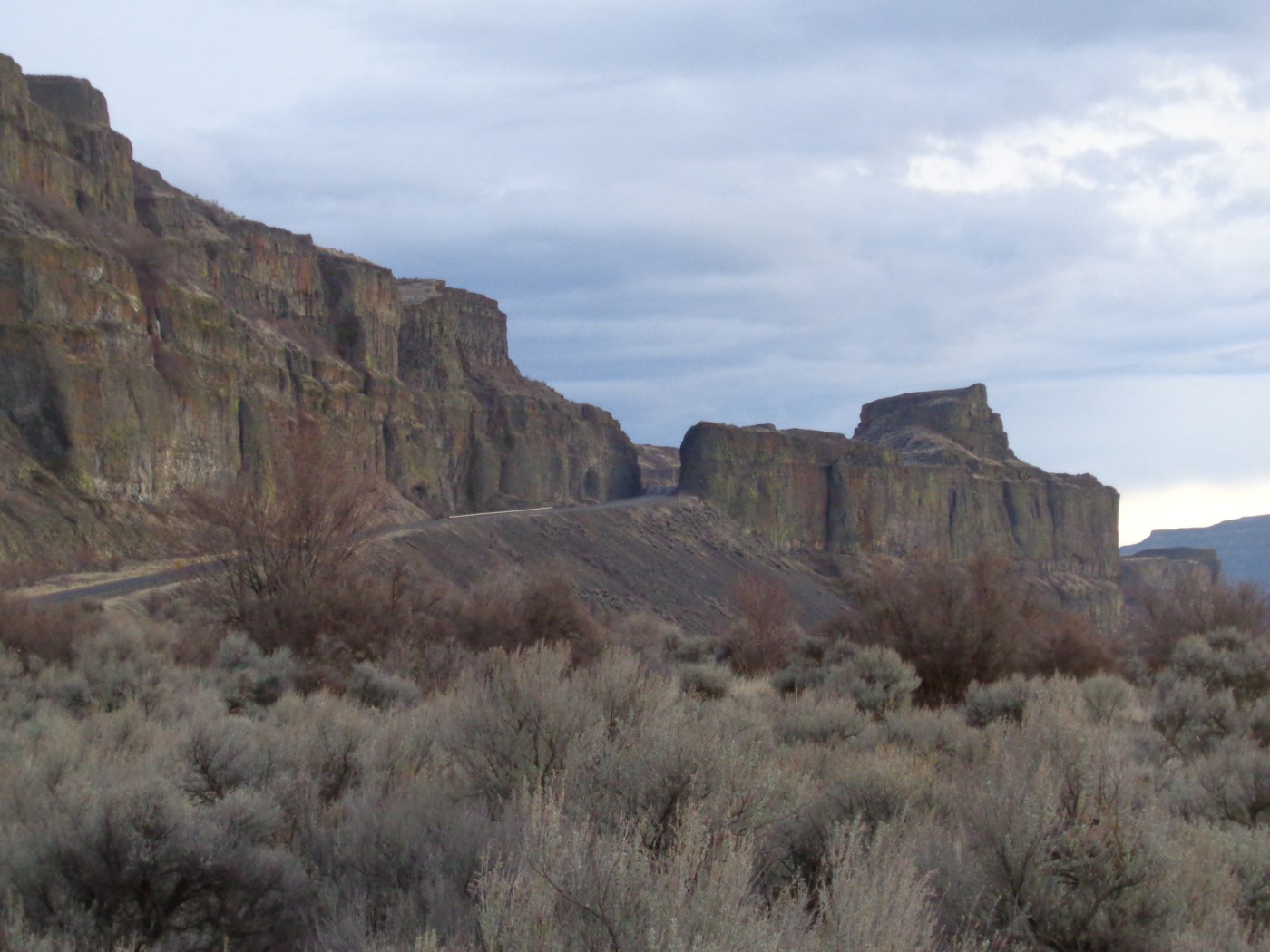
Million Dollar Mile pt 1
With the second World War over, work started on the second part of the Grand Coulee Dam: irrigation. The majority of the Upper Grand Coulee would be flooded with a 27 mile long reservoir, from Electric City to Coulee City. By 1948 Coulee City was filled with people from all over working on various projects. One project was a new highway. The old highway ran almost down the center of the Upper Coulee, the new one would have to cling to the south wall to avoid being flooded when the reservoir was full. The new highway was named Secondary State Highway 2F, and ran through several farm yards and ranches as it made its way across the coulee wall the length of the new lake. At one point just outside of Coulee City the ground at the base of the east wall was to unstable due to a series of unpredictable alkali lakes and 2F was detoured up and across the top of the plateau on an impossible looking ramp built out of local and native materials. At the top of the ramp the workers leveled the land by creating a deep channel for the cars to pass through before reaching the very top of the mesa. From there you can drive along the edge of a 600 foot drop into the man made lake before descending down the other side with a spectacular view of Steamboat Rock. The stretch of highway became known as the Million Dollar Mile and the highway became SR155.
Million Dollar Mile pt 2
When the Million Dollar Mile outside of Coulee City was created it inadvertently ran through a field with a level area and a natural spring surrounded by trees. For uncounted years this was a camping spot for the original nomadic inhabitants of the Upper Grand Coulee. The spring was nestled up on the cliff wall just out of sight, and the trail up ran along a cut to the south east. Once there was a large stone table for preparing food and families gathered together at the spring for generations. Down below in the coulee were several lakes that attracted game, and abundant produce grew wild in the surrounding landscape. To the west of the spring was Salishan Mesa, it’s original name forgotten, standing tall and proud above the landscape, teetering on the edge of the coulee wall. From on top of the mesa Steamboat Rock could be seen in the distance, and down below in the coulee the main trail leading to it. Sometimes if you listen closely enough you will hear tales of a tragic battle that took place in the coulee below, under the watchful eye of Rabbit Rock and Salishan Mesa.
Million Dollar Mile pt 3
According to the legend, in a fit of rage Coyote flung Rabbit from the top of Steamboat Rock where he landed and stuck in the side of the coulee wall below Salishan Mesa. Rabbit was then changed to stone and became Rabbit Rock. One of the earliest postcards from the 1930’s identifies the rock basalt column as Rabbit Ears Rock, and at one time the ears stuck further out the top than they do today, giving the rock an even more rabbit like appearance. At one time the Old Speedball Highway ran under the rock and people would take shots at the rabbit from down below. Some people say this is why the rabbit’s ears are so short, others say it was because of the blasting during the construction of the Million Dollar Mile. Rabbit Rock is still there, looking North to Steamboat Rock. At the bottom of the North end of the Million Dollar Mile is Payne Gulch, where old Len Dillman lived in his golden years until dying suddenly in a wreck. Word is his old, dilapidated Model T truck went off the road and hit a big boulder, flying all to pieces and killing the Optimistic Bachelor, as he was known. A slice of the old road on which he was traveling can still be seen running from Banks Lake to Larsen Falls.
published over three months in the Star news, Grand Coulee

Great History of our area! Thanks