this was written for the Grant County Tourist Board and appeared in the 2019 Grant County Trail Guide.

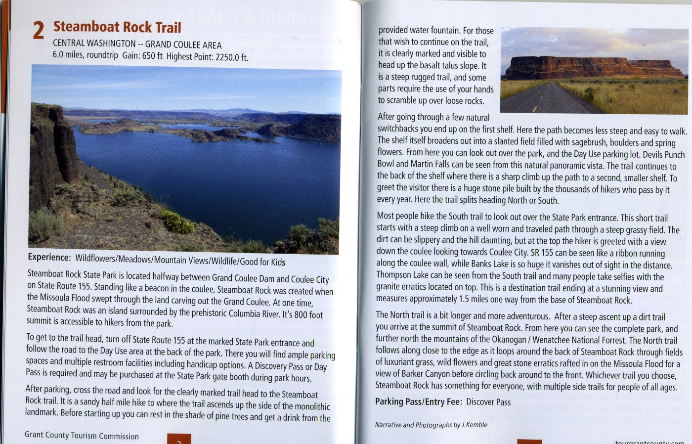
Steamboat Rock State Park is located halfway between Grand Coulee Dam and Coulee City on State Route 155. Standing like a beacon in the coulee, Steamboat Rock was created when the Missoula Flood swept through the land carving out the Grand Coulee. At one time, Steamboat Rock was an island surrounded by the prehistoric Columbia River. It’s 800 foot summit is accessible to hikers from the park.
To get to the trail head, turn off State Route 155 at the marked State Park entrance and follow the road to the Day Use area at the back of the park. There you will find ample parking spaces and multiple restroom facilities including handicap options. A Discovery Pass or Day Pass is required and may be purchased at the State Park gate booth during park hours.
After parking, cross the road and look for the clearly marked trail head to the Steamboat Rock trail. It is a sandy half mile hike to where the trail ascends up the side of the monolithic landmark. Before starting up you can rest in the shade of pine trees and get a drink from the provided water fountain. For those that wish to continue on the trail is clearly marked and visible headed up the basalt talus slope. It is a steep rugged trail, and some parts require the use of your hands to scramble up over loose rocks.
After going through a few natural switchbacks you end up on the first shelf. Here the path becomes less steep and easy to walk. The shelf itself broadens out into a slanted field filled with sagebrush, boulders and spring flowers. From here you can look out over the park, and the Day Use parking lot. Devils Punch Bowl and Martin Falls can be seen from this natural panoramic vista. The trail continues to the back of the shelf where there is a sharp climb up the path to a second, smaller shelf. To greet the visitor there is a huge stone pile built by the thousands of hikers who pass by it every year. Here the trail splits heading North or South.
Most people hike the South trail to look out over the State Park entrance. This short trail starts with a steep climb on a well worn and traveled path through a steep grassy field. The dirt can be slippery and the hill daunting, but at the top the hiker is greeted with a view down the coulee looking towards Coulee City. SR 155 can be seen like a ribbon running along the coulee wall, while Banks Lake is so huge it vanishes out of sight in the distance. Thompson Lake can be seen from the South trail and many people take selfies with the granite erratics located on top. This is a destination trail ending at a stunning view and measures approximately 1.5 miles one way from the base of Steamboat Rock.
The North trail is a bit longer and more adventurous. After a steep ascent up a dirt trail you arrive at the summit of Steamboat Rock. From here you can see the complete park, and further north the mountains of the Okanogan / Wenatchee National Forrest. The North trail follows along close to the edge as it loops around the back of Steamboat Rock through fields of luxuriant grass, wild flowers and great stone erratics rafted in on the Missoula Flood for a view of Barker Canyon before circling back around to the front. Whichever trail you choose, Steamboat Rock has something for everyone, with multiple side trails for people of all ages.


Leave a comment